
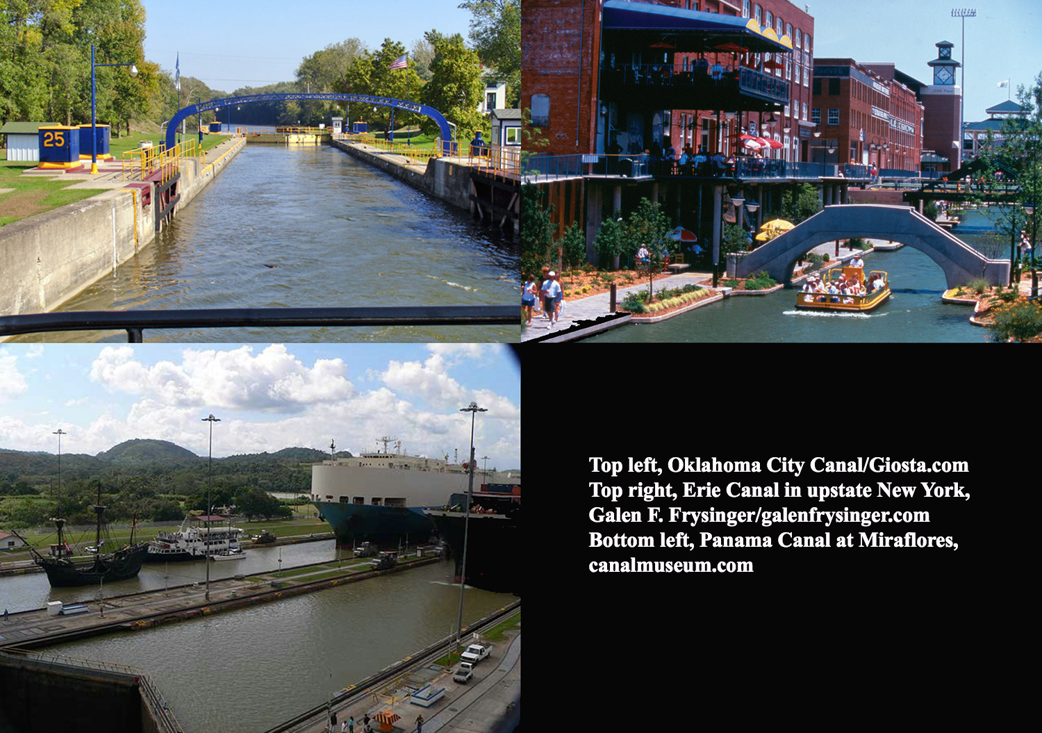
The Arkansas River Infrastructure Task Force is looking at the possible creation of a canal or channel that would follow the natural contour of the river from just south of Zink Dam to the northern edge of the south Tulsa/Jenks dam, or approximately 75th Street and Riverside Drive. The “training” of the water, officials say, would look nothing like the images pictured above. Courtesy
A canal being contemplated for construction in the Arkansas River would look less like something you would find in Panama and more like the “living river” proposed as part of a 2007 river-development plan, a Tulsa city councilor said Wednesday.
“It is not something that would run a straight line like the Panama Canal or something like that,” said G.T. Bynum. “This is something that would follow the natural contour, natural run of the river.”
Bynum is chairman of the Arkansas River Infrastructure Task Force. The group has spent nearly two years examining how to provide a sustained flow of water in the river that would provide recreational and economic development opportunities for Tulsa and surrounding communities.
The “canal,” as Bynum referred to it at the task force’s meeting two weeks ago, is being examined as an alternative to constructing a low-water dam at 49th Street and Riverside Drive. Both options are still on the table, Bynum said.
The canal would run from the south side of Zink Dam at approximately 29th Street to the north end of the lake created by the south Tulsa/Jenks dam, or approximately 75th Street.
Engineer Bill Smith is looking at two options for “training,” or directing, the disparate flow of the water — digging into the riverbed or building on top of it, Bynum said.
“So you can either dig down and create that canal or you can build up and build sort of a berm out of rock that serves the same purpose,” Bynum said. “The purpose of both is to focus the water that is spread out over the whole very wide river bed into a more focused area.”
The size of the channel or canal will determine what size boat will be able to pass through it, Bynum said. The channel or canal would be no deeper than the lakes at Zink Dam and the south Tulsa/Jenks dams, which will be eight to 10 feet deep, Bynum said.
“You can’t say with certitude what type of boat would be allowed to go through until the engineering comes back,” Bynum said.
“Now, are you going to have barges going up and down the Arkansas River? Of course not. Large boats? No.”
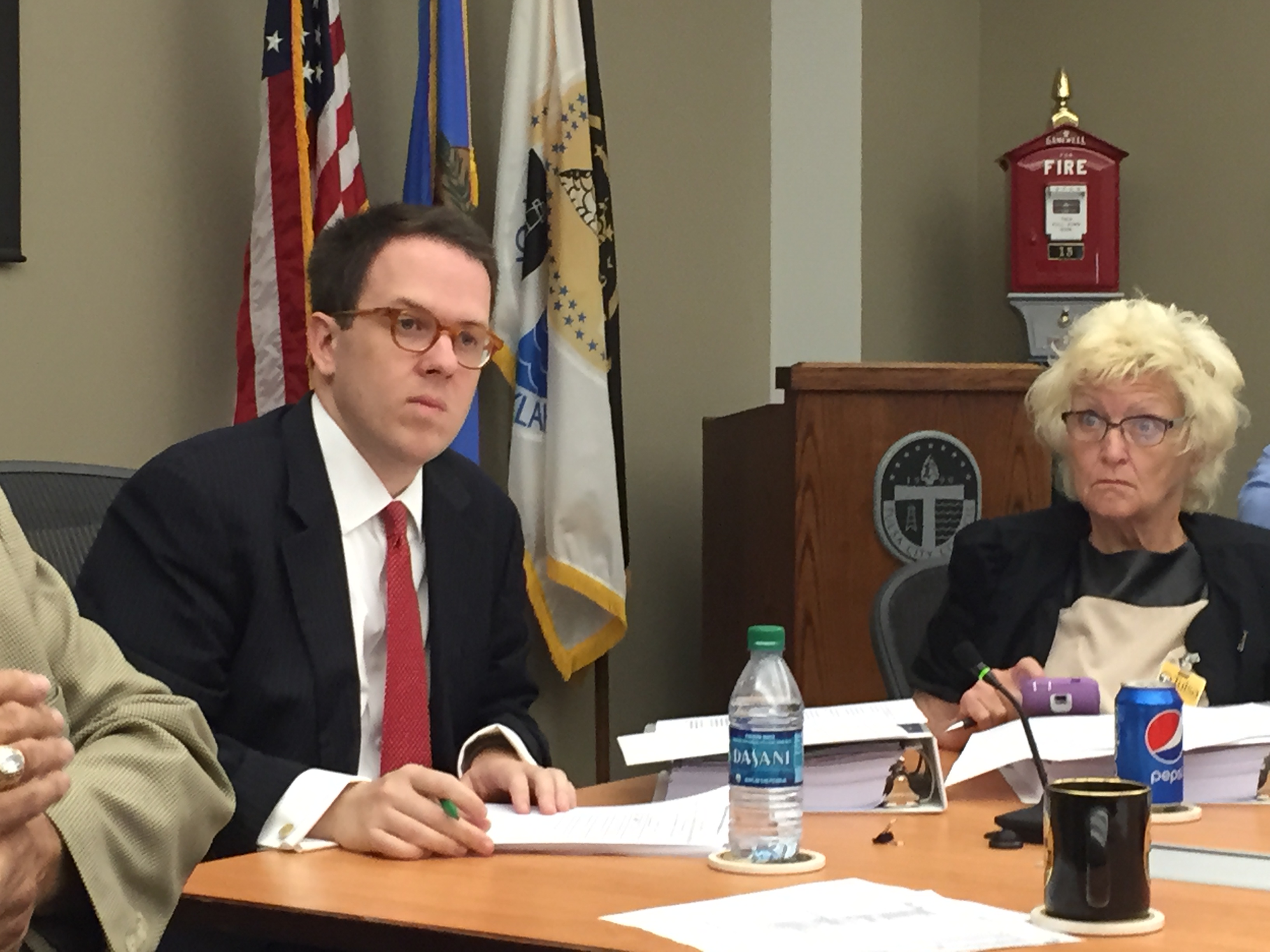
City Councilor and Arkansas River Infrastructure Task Force Chairman G.T. Bynum speaks during a recent meeting. KEVIN CANFIELD/The Frontier
During the task force’s meeting two weeks ago, Bynum noted that the living river concept had been part of the 2007 river-development package.
That $154.85 million countywide initiative, which included funding for the living river, was rejected by voters. That package would have included low-water dams in Sand Springs and south Tulsa/Jenks and privately funded enhancements and gathering spots along the river.
The 2007 river proposal was separate from The Channels, an idea that gained some traction in 2006 but never made it to a public vote. That $788 million public-private plan called for creating three linked, self-contained islands in the Arkansas River. The islands would have included housing for up to 3,000 people as well as public spaces for cultural and entertainment venues.
The 2007 living river concept was pitched by the George Kaiser Family Foundation as a possible way to provide a steady, concentrated flow of water in the river.
George Kaiser told the Tulsa World in February 2007 that GKFF was developing plans for a four-mile stretch of living river from Zink Dam to 71st Street.
The idea, Kaiser said, was to “unite the braided streams” of the river to create an environment that would spur the addition of public amenities and private development along its banks.
Elizabeth Shreeve, a principal with SWA, a California architectural and urban design firm hired by GKFF, told the World that the disparate streams of water in the river during low flow could potentially be concentrated into one 500-foot-wide channel that would follow the natural meanderings of the river.
When there was more water in the river, it would flow as needed throughout the entire 1,500-foot-wide expanse of the riverbed, Shreeve told the World.
And then, sounding much like Bynum two weeks ago, she added: “You could take a canoe at 31st Street and spend the day going down the river, then drop the canoe off at 71st Street …”

Proposed Phase 1 low-water dams. Click on image to enlarge.
Bynum said Wednesday that he knows little more about the living river proposal than what was reported in the World but that what is being contemplated currently “sounds similar” in concept.
One striking difference from the 2007 proposal and the one being discussed now is that the current plans are — and will be — “infinitely more detailed and fleshed out” than those presented in 2007, Bynum said.
In 2007, Kaiser cautioned that “this has not been studied fully, and we don’t want to promise something that doesn’t work out in this fashion.”
In fact, Jeff Stava with GKFF told The Frontier last week that no engineering work on the living river concept was ever done.
Bynum struck a similar note of caution at the task force’s meeting two weeks ago, saying modeling on the living river idea is being done to “give us a better idea if this is an unrealistic idea or it is a realistic one.”
