

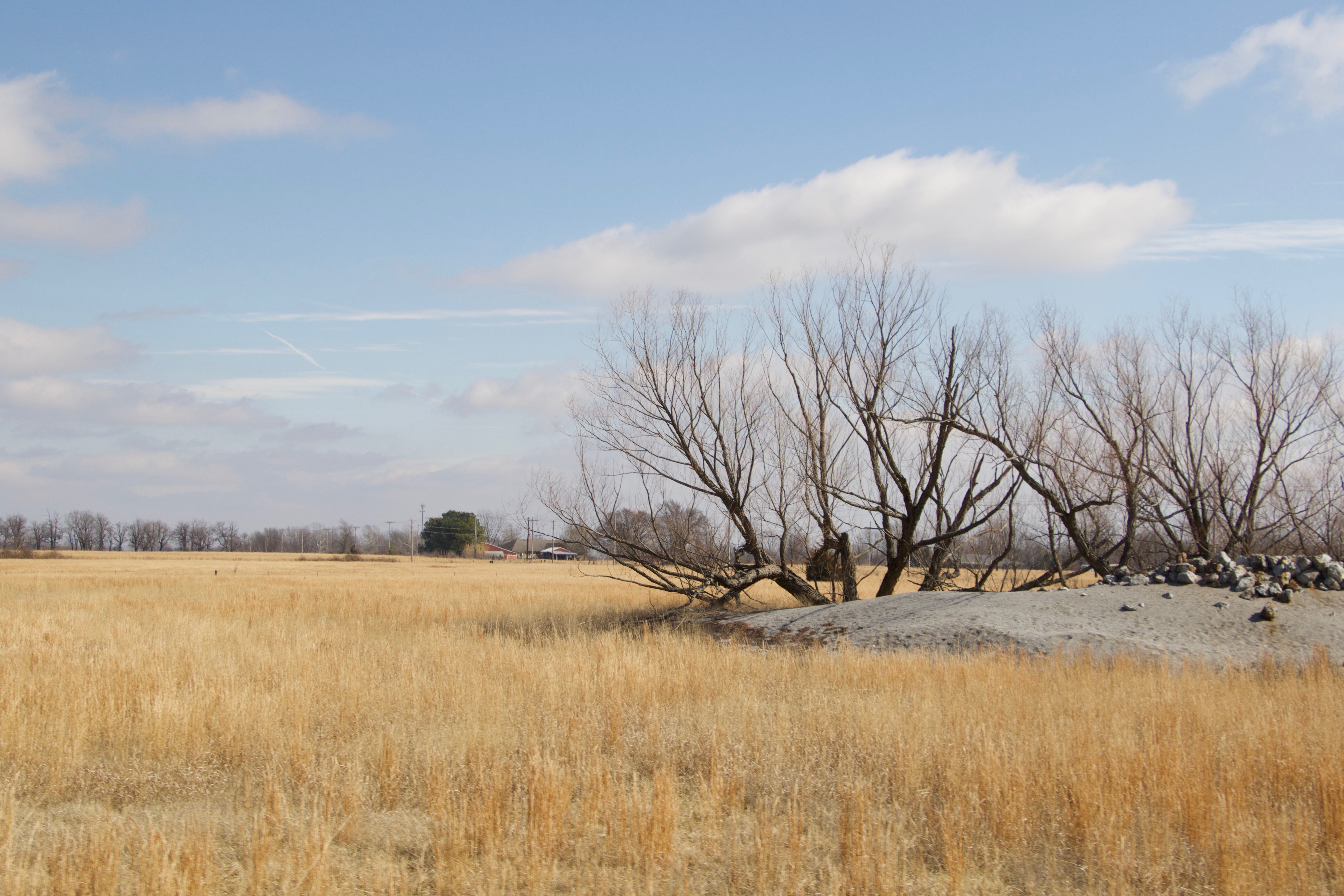
Tar Creek after its convergence with water flowing from a mine shaft along a roadside ditch and Lytle Creek. The banks are lined with toxic chat deposits that have washed down the creek. CLIFTON ADCOCK/The Frontier
OTTAWA COUNTY — A little stream of clear, yet highly toxic water bubbles out of the man made berm meant to contain it.
The stream’s clarity belies the high levels of heavy metals — lead and zinc — it contains, after flowing from a massive hill of mining waste before collecting at the berm built to prevent it from escaping the area. The idea is to allow the water that flows from the pile of mining waste to collect in a pond near the base of the pile, where the sediments containing the toxic metals will eventually settle to the bottom.
But a section of the berm has eroded away. Now, the water flows out of its enclosure, eventually reaching a ditch alongside a lonely dirt road.
From the ditch, the water flows into a nearby body of water that gave name to one of the largest and most expensive superfund sites in history — Tar Creek.
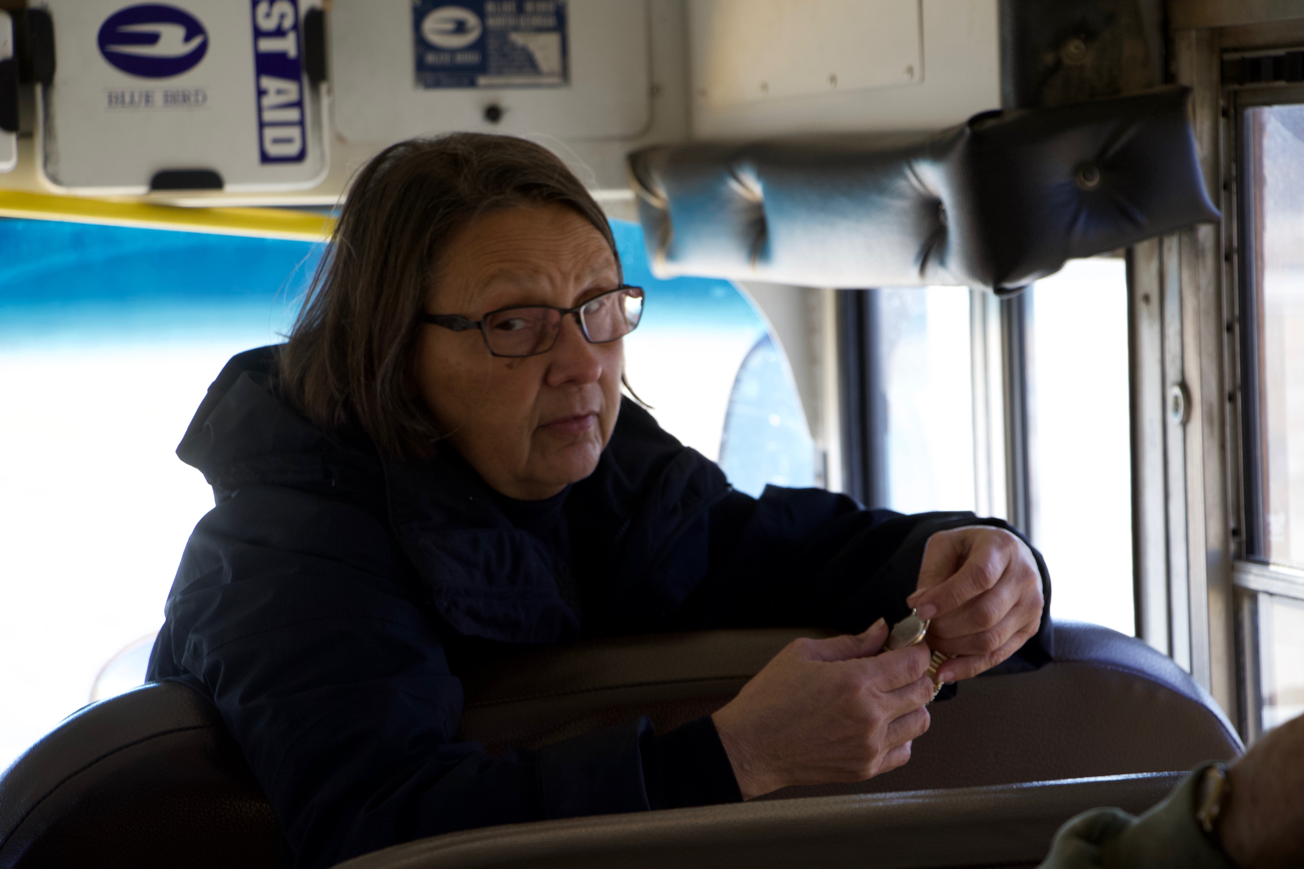
Local resident Virgil Tarter sits behind the steering wheel of a yellow school bus, looking out at the water flowing from the berm.
“It breached the berm and it’s not supposed to be there,” Tarter tells the passengers of the bus.
“What does that mean?” one of his passengers asks.
“That’s unacceptable. It’s been like that for three years now. Nothing is supposed to go past the berm,” Tarter replies. “Any water that runs off of that hill should go around into a sediment holding place.”
How would Tarter know that?
“I used to have to walk this every three or four weeks, monthly,” Tarter says, recalling his days working for a company that provided remediation and monitoring of the Tar Creek site. “It was my job to make sure the water was not breaching the berm.”

Water can be seen leaking from a berm meant to keep the toxic water flowing from a chat pile contained. The water was flowing into a roadside ditch and east into Tar Creek. CLIFTON ADCOCK/The Frontier
Tarter is part of a nonprofit group headquartered in the nearby town of Miami known as the LEAD Agency — Local Environmental Action Demanded. And on Saturday Feb. 17, he and others from the LEAD Agency led a tour of the Tar Creek area by members of the Sierra Club’s Green Country chapter, accompanied by The Frontier.
The background briefing
Seven members of the Green Country chapter of the Sierra Club sit on couches or at a large dining room table covered with fliers, reports, maps and other documents. The group drove to Miami on the overcast morning, where they met with the members of the LEAD Agency who would take them on the tour of the 47-square mile Tar Creek superfund site.
The LEAD Agency’s headquarters is in house built in the early 20th Century and decorated with environmentally-themed signs, pictures and artwork from local school students.

Pictures hanging the LEAD Agency’s headquarters in Miami. CLIFTON ADCOCK/The Frontier
Like many other houses, playgrounds and public works in the area, parts of the Lead Agency’s headquarters’ stone work was built with rocks and other materials that came from mining operations, says Rebecca Jim, a former school counselor who is now director of the organization.
“In every way you could use it, they used it,” Jim said.
Before starting the tour of Tar Creek, Jim, along with Tarter, and LEAD Agency’s Grand Riverkeeper Earl Hatley provided the Sierra Club members with some background on Tar Creek.

LEAD Agency Executive Director Rebecca Jim (left) and agency Grand Riverkeeper Earl Hatley (right) explain the history of the Tar Creek site to members of the Green Country chapter of the Sierra Club. CLIFTON ADCOCK/The Frontier
The Tar Creek area in Ottawa County was part of the Tri-State Mining district encompassing parts of northeastern Oklahoma, southeastern Kansas and southwestern Missouri. Much of the area is considered Indian land and is held in trust by the U.S. government for members of the Quapaw Tribe.
The area was rich in lead and zinc ore, and mining operations began in the area in 1891, though production didn’t ramp up in a major way until 1914, when a major ore discovery was made near the town of Picher. Four years later, there were 230 mills used to process the raw ore operating or under construction in the Oklahoma section of what had become known as the “Picher Field,” helping to feed the local economies of Picher, Cardin, Commerce, Miami and others. During World War I and World War II, the area produced much of the lead and zinc used in the American war efforts.
To mine the ore, workers would use a “room and pillar” technique by mining out large rooms underground and leaving large pillars in place to support the ceiling, some of which stretched 100 feet high.
“Some of those rooms were the size of the Superdome,” Jim said. “Then there might be another one beneath that, and then another one beneath that.”
Jim pulls out a sealed glass jar which she hands to one of the Sierra Club members to pass around. Inside the jar is a sparkling grey metal — lead.
“It’s really beautiful,” Jim said. “That’s what they said, when the miners went in after they would would open a new room, how beautiful it was before it started to oxidize.”

A sealed glass jar of lead. CLIFTON ADCOCK/The Frontier
By the time mining operations had mostly ceased in the late 1970s, more than 1,000 mine shafts and around 100,000 exploratory bores had been dug in the Oklahoma part of the mining district, leaving more than 300 miles of underground mines and tunnels, according to the EPA and Oklahoma Department of Environmental Quality.
However, the Picher Field didn’t just sit on a large ore deposit — it also sat on an aquifer known as the Boone Aquifer. That presented a problem as mining operations went deeper and deeper into the earth.
To keep the operations running and the work areas dry, the groundwater would be pumped out of the mines by the mining companies, Jim said.
Once ore was extracted from the mines, they were taken by rail car or truck to a mill. The mills were used to grind down the rocks that were mined in order to extract the lead and zinc ore from stone, using either a wet or dry process. The dry process produced large hills of a gravel-like waste known as “chat,” while waste from the wet process was deposited in ponds and produced collections of fine sand and silt-like material known as “fine tailings.” Both types of waste have high concentrations lead and zinc, though the fine tailings — or “the fines,” as they’re sometimes called by locals — have much higher concentrations.
The fine tailings are also produced when operations “reprocessed” chat for sale and use in road construction and concrete production. During reprocessing, the chat is “washed” to remove as much lead as possible prior to being sold, leaving the fine tailings as waste.
At one point, the area had a location known as “The Beach,” which consisted of a large amount of fine tailings, Jim said. A person could stand on the pile, shift their feet back and forth and within a few minutes be buried up to their chin, Jim said.
“There’s bigger rocks and there’s smaller rocks, then there’s gravel, then there’s a kind of sand, then this is the stuff the washes through,” Jim said. “So the fines would be very, very soft. It dries out and it’s powder.”
One of Jim’s former students later told her that her father had built a sandbox for her and filled it with fine tailings for her to play in as a child. Later analysis of baby teeth from people who lived in the area showed that the woman had one of the highest concentrations of lead of anyone analyzed in the project, Jim said.
After the end of World War II, the price of and demand for high-grade zinc and lead ore fell, and production from the mines began to decrease, and the last significant production of ore from Ottawa County occurred in 1970. Local towns that had thrived off the jobs and economic impact of the mines shrank or disappeared entirely.
The mining operations left about 500 million tons of waste in the Tri-State area, including chat piles, chat bases (former piles of chat), and the silt-like fine tailings left behind after the disposal ponds evaporated. A 2005 survey by the EPA found that, in the Oklahoma part of the district there were 83 piles of chat occupying 767 acres, 243 chat bases occupying 2,079 acres and 63 fine tailings ponds occupying 820 acres.
Though the piles of toxic material and ponds in the area left on the surface by mining companies after operations ceased in the late 1960s and early 1970s was already a major environmental problem, there would be more to come.
When the mining operations shut down, so did the pumps keeping water out of the mines, Jim said.
Water flowed into the abandoned mines, both groundwater and water pouring in from the surface through the open mine shafts.
“These empty caverns would fill up with water. You had the metals, but you also had sulfur and you also had oxygen — and now you have sulfuric acid,” Jim said. The acid causes the metals left in the mine to dissolve into the water. “It becomes an acid that puts all of those other metals into solution. So when the mines are as full as they can get, like when your bathtub is as full as it can get, they’re going to come out.”
Nine years after the pumps were shut down, the “bathtub” finally overflowed, spilling the acid water into Tar Creek and killing fish and other aquatic life and leaving. The banks of tar creek were lined with dead fish all the way down to the Neosho River, Jim said.
“The mining companies, they knew in 1947 that if they turned off those pumps, that it would ruin our beautiful lake,” Jim said.
The fish kill got the Environmental Protection Agency and the Oklahoma government’s attention.
“That’s what started EPA coming in and looking at all this and this becoming a Superfund site,” Hatley said. The site was declared a superfund site by the EPA in 1983.

LEAD Agency Grand Riverkeeper Earl Hatley discusses the history of the Tar Creek site with members of the Green Country chapter of the Sierra Club prior to heading out on a tour of the site. CLIFTON ADCOCK/The Frontier
In the mid-1970s, environmental catastrophes such as Love Canal and Valley of the Drums had captured the public’s attention, and in 1980 Congress passed the Comprehensive Environmental Response, Completion and Liability Act, often referred to as Superfund. The act, which was amended and renewed in 1986, forced responsible parties to clean up contaminated sites, allowed the EPA to clean up sites where there was no responsible party who could or would do cleanup, and collect triple the cleanup costs from parties that failed to clean contaminated sites.
It also levied a tax on industries related to petroleum and chemical production and put the money into a trust fund to pay for site cleanup.
However, in the mid-1990s, Democratic President Bill Clinton and the Republican-controlled Congress failed to come to an agreement reauthorizing the Act and it expired. By 2004, funds in the Superfund Trust had run dry, and the EPA was relying solely on appropriated funds from Congress, often in the form of riders attached to other bills, Hatley said.
“There’s isn’t any longer a fund. So, in order to appropriate money for these sites, it literally takes an act of Congress for each appropriation for each site, incrementally paying for the cleanup of these sites,” Hatley said. “For big sites like Tar Creek, it becomes very difficult to get things done as a result.”
Hatley and Jim both said they plan to advocate for bringing back funding for the Superfund Trust.
“Superfund is broke and we need it fixed. We need the polluter-pays fees reinstated,” Jim said. “It’s a perfect time, now that industry has gotten a tax break.”
Hatley said he has been frustrated in trying to get people to pay attention to the issues at Tar Creek. Hatley pointed to the outrage in 2015 about the Animas River Colorado, when a spill by EPA workers sent more than 3 million gallons of polluted gold mine wastewater pouring into the river, turning the river orange.
“Every three days we have that (waste) equivalent run down Tar Creek into the Neosho River and into Grand Lake,” Hatley told the group.
“People swim in Grand Lake,” one Sierra Club member remarked. “We drink Grand Lake,” Hatley replied. “It’s a primary drinking water source for the communities down there and rural water districts up here.”

LEAD Agency Grand Riverkeeper Earl Hatley at the agency’s headquarters in Miami. CLIFTON ADCOCK/The Frontier
Commerce
Tarter navigates the school bus through Miami north to the town of Commerce, home of legendary baseball player Mickey Mantle.
But Commerce, like much of the area, is sinking, Jim said.
The caverns and holes left by the massive mining operations that occurred there often leave massive sinkholes.

A map showing mine locations in Ottawa County, represented by the dark areas. The small dark areas located below LEAD Agency Executive Director Rebecca Jim’s hand is the town of Commerce. CLIFTON ADCOCK/The Frontier
Jim points to a field behind Commerce High School. In the field are solar panels and a pond — part of a remediation project. The materials put into the pond filtered for the metals they contain, which are then sold, she said.
There is also an empty field next to the pond. It was to be a soccer field for the high school, but it caved in so many times that work on any sort of improvement there was abandoned, she said.
The appearance of sinkholes even prevented a large swath of the town from ever growing, Jim said.
Small chat piles begin to appear sporadically alongside the road as the bus heads north out of town.
“40 Road”

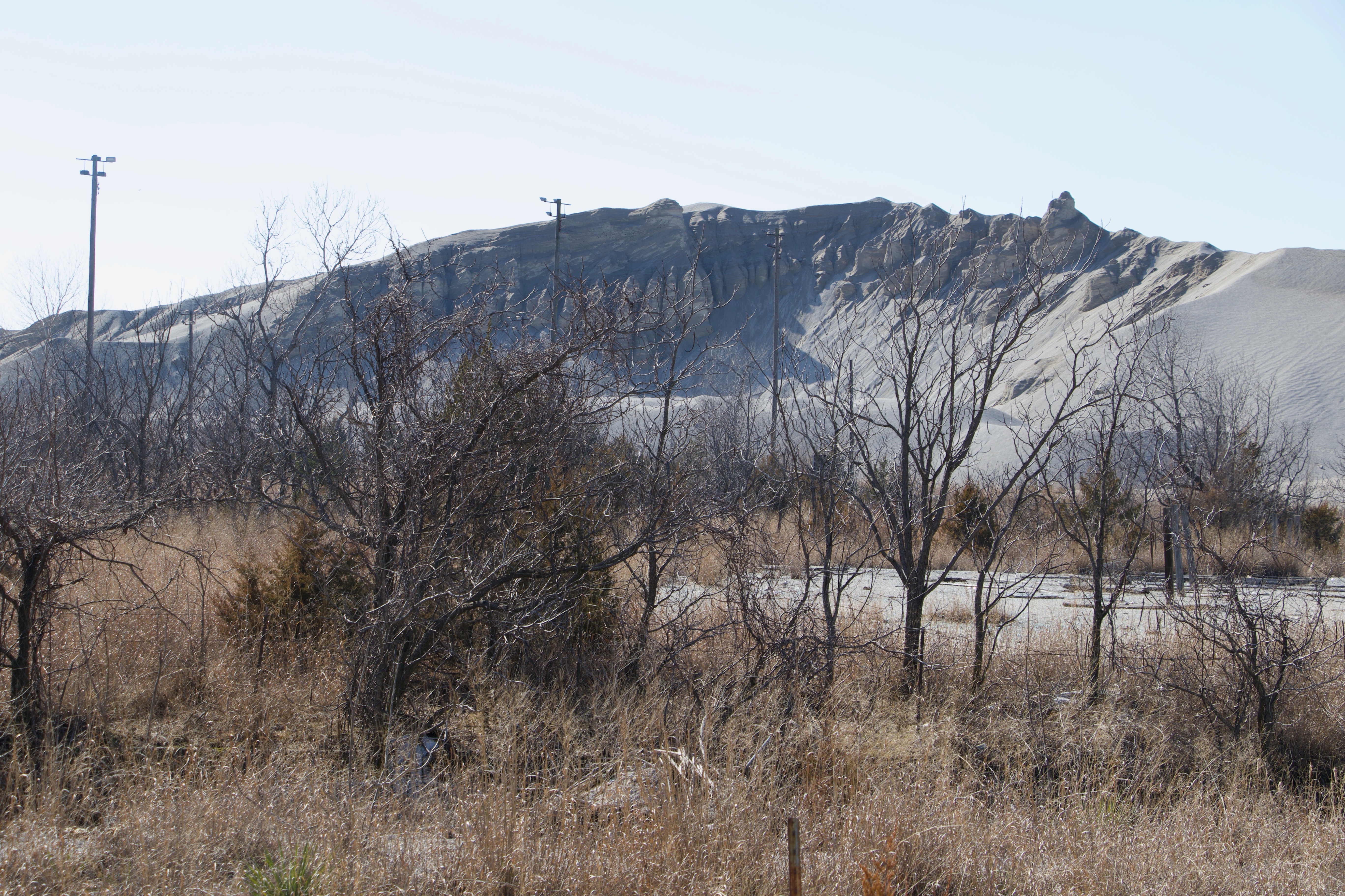
A large chat pile located on the north side of 40 Road. CLIFTON ADCOCK/The Frontier
As Tarter drives the bus north on U.S. Highway 69 toward the Kansas-Oklahoma border, an enormous grey hill of chat looms above the treeline to the west.
That, Tarter said, “is what we call the repository. That’s where they’re stacking up all of the fine tailings or contaminated soil” from around the area.
One of the largest chat piles in the area was known as the “GE Pile,” which was near the repository Tarter said. Chat from the pile was hauled off in all different directions, for use in road and concrete work around the county, he said. When work on the pile was finished, fine tailings between 17 and 21 feet deep were left where the pile once stood, he said.
“Instead of trying to clean it up and find and try to find a place to put it, they just piled everything else on top of it,” he said.
The idea, Hatley said, is to consolidate all contaminated material — unmarketable chat, fine tailings, remediated soil from residential areas — into just a 11 piles. When finished, the piles will be covered with soil and vegetation planted on them. These man made hills will then be monitored forever to make sure no contamination is leaking out, Hatley said.
“The problem is the groundwater is already contaminated, totally,” Hatley said. “All over this part of the county, the Boone Aquifer is highly contaminated. So it’s been written off.”

LEAD Agency Grand Riverkeeper Earl Hatley tells members of the Green Country chapter of the Sierra Club about Tar Creek, while agency member Virgil Tarter drives the bus. CLIFTON ADCOCK/The Frontier
Tarter pulls the bus off the highway and onto a dirt road known as “40 Road.”
To the south are the remnants of a chat pile. To the north, just off the road, is a massive, grey pile of chat.
People used to bring their dune buggies and motorcycles to ride them on the chat piles, Tarter said.
A further west, the concrete foundation of a church that was burned down about a year ago sits just off the road to the north. Further west, massive concrete pillars that once formed the skeleton of mine and mill operations structures stand silently among the trees.

Members of the Green Country chapter of the Sierra Club take photos as the tour leads them past a large pile of chat. CLIFTON ADCOCK/The Frontier
Tarter points to a pile of boulders in a field south of the road.
“Every time you see a rock pile, if you look around and check it out, there’s probably a mine shaft,” Tarter said. “These are the boulders they pulled up out of the mine and they just discarded them. There may be multiple shafts around.”
Tarter stops the bus near a chat base that has grass growing on it, where the Sierra Club members were allowed to climb to the top to survey the surrounding area.
As the group climbed the hill, Hatley, walking stick in hand, began walking west on the road by himself toward a bridge.

Members of the Green Country chapter of the Sierra Club survey the surrounding landscape from atop a chat base. CLIFTON ADCOCK/The Frontier

Barbara VanHanken, chair of the Green Country chapter of the Sierra Club, hikes down a hill of chat base with other club members. CLIFTON ADCOCK/The Frontier
After the group was back on the bus, Tarter continued, tracing Hatley’s route west down the road. He stopped briefly at a pond near the side of the road and near the base of a chat pile.
“You can see where they scrape everything out they can sell. This is what’s just been left. They didn’t clean it up,” Tarter said. The pond, a leaching pond, catches the water coming off the chat pile, he said. The sediments settle to the bottom and some of the more settled ponds are beginning to show signs of life, he said.
Tarter pulled alongside a steel pipe protruding out of the ground. The top of the pipe has been capped, and secured with a lock to keep people from dumping things down it, he says.

A monitoring well leading down into a mine shaft. The well is sealed and locked. CLIFTON ADCOCK/The Frontier
“Seventy-five to 100 feet down, they have a cavern and it’s all hollow,” Tarter says. “They have a mine shaft into the cavers so people can go up down. Then they have air vents so they can pull in air for the miners. Now that they’re filled up with water, they’ve designated them as monitoring wells.”
When he worked for a remediation company, Tarter said crews would run cameras down some of the holes. At 75 feet, light no longer penetrates the water and the images are pitch black. Then, at about 160 feet, movement can be seen on the camera — silt disturbed by the camera hitting the bottom of the shaft.
Along the roadside, clear water pours out of a hole in the ground and into the ditch, flowing west. The grass and soil surrounding the hole is stained a burned orange color, and the grasses touching the surface of the water have accumulated a dull orange scum.

Contaminated water flows out of an air hole leading to a mine alongside the road. The water eventually flows into Tar Creek. CLIFTON ADCOCK/The Frontier
“That would be rust,” Jim says. The hole is actually an air hole going down into one of the mines that is now overflowing with water, she said. Though the water is clear, it’s highly contaminated with heavy metals, Jim said.
“In 1994, it was a square hole and there was nothing coming out of it,” Jim said. “The geology is changing.”

Contaminated water flows out of an air hole leading to a mine alongside the road. The water eventually flows into Tar Creek. CLIFTON ADCOCK/The Frontier
The water flows west down the ditch along the road to a bridge. It is there the water flows into Tar Creek.

The water flowing out of the mine air hole travels along a ditch on the side of 40 Road, eventually flowing into Tar Creek. CLIFTON ADCOCK/The Frontier
Tar Creek
Hatley stands near the bridge on 40 Road over Tar Creek, waiting for the bus and the rest of the group to catch up to him.
Just on the north side of the bridge is the confluence of three bodies of water — Tar Creek, Lytle Creek and the stream of water pouring from the mine shaft along the road.

Tar Creek (top) converges with Lytle Creek (center) and water flowing from a mine shaft down a ditch alongside 40 Road (bottom). Separating Tar Creek from Lytle Creek is a deposit of chat that has washed down the creek. CLIFTON ADCOCK/The Frontier
To the north, Tar Creek’s relatively clear water makes a straight line to the bridge. There’s life in the creek up to this point, Hatley says. Minnows can often be seen from the bridge swimming downstream.

Tar Creek as it flows south to meet Lytle Creek. CLIFTON ADCOCK/The Frontier
However, water from Lytle Creek flows into Tar Creek from the northeast, and the ditch water flows into the creek from the east.
The water in Lytle Creek is a deep rust color, and the trees near the creek are stained orange a few feet up their trunks, signs of where the creek flooded. It’s at this point, Hatley said, that any fish swimming downstream must turn back or die.

LEAD Agency Grand Riverkeeper Earl Hatley points out the stained trees lining the creek, indicating where the creek has flooded. CLIFTON ADCOCK/The Frontier
When the EPA presented their plan to try and limit surface water contamination of Tar Creek and prevent contaminated water from the Boone Aquifer from flowing into the Roubidoux Aquifer, Lytle Creek was a major concern. The EPA’s plan was to build a series of dams and dikes to divert Lytle Creek away from nearly sinkholes in an effort to prevent water from flowing into the mines, and mine water from flowing into the creek.
Work on the project was completed in 1986.
While there were some successes, it failed to prevent water from the mines from escaping into Lytle Creek and Tar Creek.
South of the bridge, the water of Tar Creek is the color of rust. A foamy green algae rests on its surface, and bars of chat washed downstream line its banks.

Tar Creek after its convergence with water flowing from a mine shaft along a roadside ditch and Lytle Creek. The banks are lined with chat deposits. CLIFTON ADCOCK/The Frontier
From the air, Hatley says, the creek resembles an orange ribbon winding its way south through Miami and into the Neosho River, though monitoring has not showed elevated levels of metals in Grand Lake, Hatley said.
However, the pollution dumped into the river by Tar Creek has caused many people to change their ways of life, Hatley said.
“They’re eating the fish,” Hatley said. “People are catching the fish, but you run into a lot of people who say ‘I used to eat the fish, but now I’m afraid to.’”

A sign marks the location of an EPA remediation project at the Tar Creek site. CLIFTON ADCOCK/The Frontier
For the most part, Tar Creek is considered a lost cause by state environmental officials, Hatley said.
“It’s been designated as dead by DEQ. It’s been written off,” he said. “It’s been this way since 1979. I’m at a point I’m not going to stand for it anymore.”
Further down 40 Road, the group is shown the water flowing out of the berm that was supposed to contain it. That water enters the ditch and flows east, draining into Tar Creek.
Golden fields, grey hills
An open field with native grass, where with a small pile of chat remains. The large boulders on the pile indicate that a mine shaft is likely nearby. CLIFTON ADCOCK/The Frontier
Tarter pulls the bus off 40 Road and heads south, back toward Commerce.
He points to the west towards a plowed field stretched out before a hill covered in yellow native grass shining in the sun that had by then broken through the clouds.
“That used to all be chat,” Tarter says. “That yellow hill up there used to all be chat.”
Remediation efforts in the area are still heavily underway. Yellow dozers and heavy vehicles are a regular site in the area, parked atop piles of chat or in fields where remediation work is being done.
Tarter says he spent days walking that field as a remediation worker, searching for contaminated soil. He regularly points out signs indicating where work has occurred and where it has not.
However, the contamination of soil by the chat piles or fine tailings often run deep. Workers will often dig many feet down into the earth to get past contaminated soil, haul the soil out and leave the pit open to form a pond.
At one location, “when you would drive by, they were going down so deep here, that the bulldozer, you couldn’t see it,” Jim says. “They went that deep to find clean soil.”
Tarter pulls west onto a road just north of Commerce. A house sits at the intersection. A large bucket filled with flowers sits in the yard.
Jim points at the bucket.
“It was what the miners used as their elevator,” she said. “Three men could stand in that bucket to be lowered down into the mine. There used to be a lot of those around here.”

A basket once used to haul miners three at a time down mine shafts is now used as a planter in a Commerce resident’s front yard. CLIFTON ADCOCK/The Frontier
Now on the westernmost edge of the chat piles, the bus turns again and heads north toward the Kansas state line, past a field of golden grass shimmering in the breeze, dotted with a few small grey piles of chat.
“This is what’s left of another pile,” Tarter says. “Somebody has cleaned this. But there’s still small piles.” Often, companies are hired to remove the chat, but will only take what can be cleaned and sold and leave the rest, he said.
The tour crossed the state line into Kansas and turned east on a dirt road coated with layer of compressed chat.
Tarter points to a grove of trees standing starkly in an otherwise empty field.
“Why did they leave that? There might be a rock pile or shaft out there,” Tarter says.
Open mine shafts are dangerous, he said. To increase safety and prevent surface water from getting in, workers would fill in as much as possible and cap the entrance with concrete. But many times the concrete will collapse, again leaving an open shaft, he said.
The dangers of open mine shafts, sinkholes and chat piles making land unusable for crops will often drive farmers to take extreme measures, Tarter said.
“If you walk along the edge of this field,” Tarter says, pointing south, “you’ll see where it’s black dirt, then it turns grey. If you test it, you’ll find where it’s fine tailings from the chat. They’ve taken the chat pile, dug off what they could and sold it. Then the farmer came back with his tractor and pushed back what he could so he could get as much land as possible that he could use.”
The bus rumbles past a larger chat pile on the south side of the road. The junk sitting at the base of the pile shows it has served as a trash dumping site in the past. Broken shards of glass mixed in with the chat sparkles in the sun. The mixture of trash, glass and chat means it will likely be very difficult and expensive to sort and sell by chat removal companies, Tarter says.
To the north, a the jagged grey peaks of a large chat pile begins to rise above the bodark trees lining the road. Entering a clearing, the scene becomes visible — Tar Creek flowing in front of a man-made mountain of mining waste.

Tar Creek flows in front of a large pile of chat, north of the location Lytle Creek meets Tar Creek. CLIFTON ADCOCK/The Frontier
Though it’s still polluted, there’s life in the creek in this area. Aquatic plants and fish can be seen in the water.
Tarter stops the bus and the visitors disembark, posing for a group picture in front of the pile.

Members of the Green Country chapter of the Sierra Club stop for a photo in front of a large pile of chat. CLIFTON ADCOCK/The Frontier

Members of the Green Country chapter of the Sierra Club and from the LEAD Agency pose for a photograph in front of a large pile of chat. CLIFTON ADCOCK/The Frontier
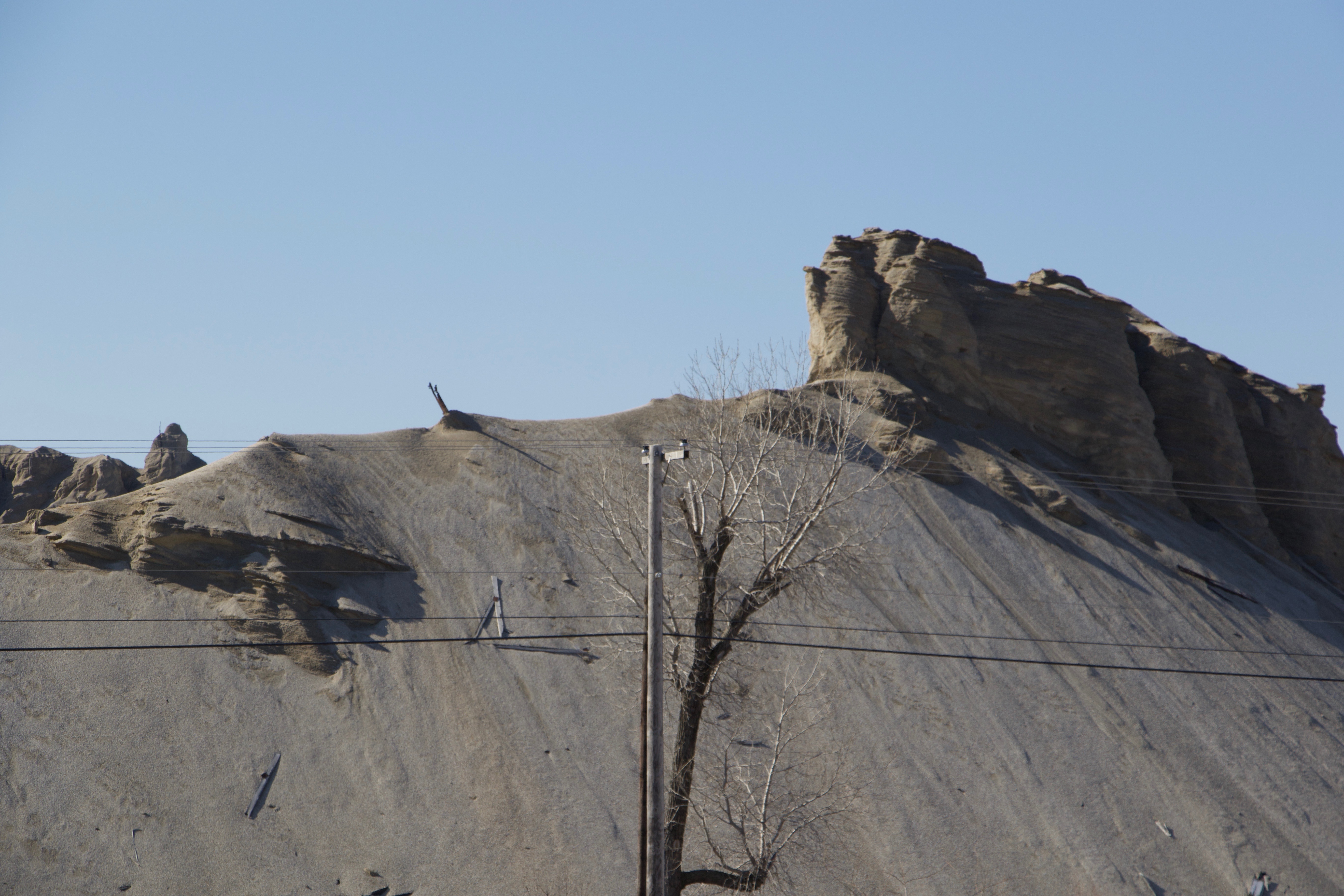
There are human footprints leading up the chat pile. Tarter said people used to, and sometimes still do, climb the piles or ride motorcycles and dune buggies on the piles.

Footprints and tire tracks going up a large pile of chat. CLIFTON ADCOCK/The Frontier
Tarter points to a section of the pile where he says it appears to be collapsing down into a hidden mine shaft located under the pile. Though there have been some attempts to put chat back into the ground, but not enough, he said.
Hatley said one of the plans presented to the EPA for dealing with the chat piles and fine tailings in the 1980s was to set up a wastewater treatment facility to pump out and clean the water in the mines, lowering the water table and keeping the mine water from surfacing.
“The problem has always been — if you put the chat down in the hole, you’re going to displace the water that’s in the mine shaft and it’s going to start pouring onto the surface and running down Tar Creek into the lake,” Hatley said. “If you have a wastewater treatment facility that’s pumping water out of the mine shaft, you can overcome that. Start pumping the water table down, especially during the dry period, then you could start putting that stuff into the sinkholes, pushing it in and monitoring the water table as you go.”
This would not only allow water from a contaminated aquifer to be cleaned and used by the community and farmers for irrigation, but also pulling metals out of the water that could then be sold to help pay for operations, he said.
Other plans by the EPA have not worked thus far, as acid water still flows from the mines into Tar Creek, Hatley said, though officials from the George W. Bush administration also reviewed the plan and recommended it as solution, the idea has continuously been dismissed by the EPA during each of its five-year reviews of the plan.
“That was in the original list of remedies for Tar Creek in 1986,” Hatley said. “They rejected it because it was going to cost $60 million. As of today, they’ve spent roughly $500 million or more on (buyouts and cleanup at) the site already, and you see how much has been done — 600 acres out of 26,000 acres have been cleaned up.”
Hatley turns toward the hill of chat behind him.
“Look at how much is left to do.”

LEAD Agency member Virgil Tarter points out to Sierra Club members footprints leading up a large pile of chat. CLIFTON ADCOCK/The Frontier
The ghost town
The bus heads south down U.S. 69, back into Oklahoma.
Tarter points out the “Sooner Pile” of chat rising up east of the highway. It is one of the oldest chat piles still around, he said.
Tarter pauses.
“Welcome to the town of Picher” he says.
Rows of houses sit empty along the streets of Picher. The remaining abandoned businesses and buildings stand silently on the sides of the highway. The town’s last holdout, a pharmacy, closed in 2015 after the owner died. The remaining residents and businesses took a federal buyout years ago and have abandoned the town.
The only parked cars are emergency vehicles — the Council on Law Enforcement Education and Training has a firearms training site in the abandoned town.
“It’s a post-apocalyptic world,” said Jim Wikel, a member of the LEAD Agency who went on the tour, as the bus passed through the abandoned town. “I had a coworker who grew up here. They talk freely about the learning disabilities that they had. They played on the piles as a kid, and talked about swimming in the ponds and sinkholes.”
Living with the remnants of the mining operation was a way of life in Picher.
“A lot of this land here, if you were to actually clean off the visible chat, it would be a foot or two feet lower than it is now,” Tarter says. “A lot of people didn’t want it cleaned because if it’s lower, it’s susceptible to flooding.”
The bus parks near two massive chat piles. In front of the piles, two light poles rise out of the brush, marking the location of the town’s former baseball field.
Lights rise of out the brush, marking the location of the old Picher baseball field. CLIFTON ADCOCK/The Frontier
“If your kids weren’t paying ball, they’d play in the chat,” Hatley said. When he was hired by the Quapaw Tribe as the environmental director, Hatley said the sight of kids playing in the toxic chat pushed him to demanded the EPA shut the ballfield down.
“I said ‘you have an office right there. You’re looking at it every day. You don’t need to take samples,’” Hatley said. “‘Your eyes can tell you what the problem is. Shut it down. Don’t let the children play in the chat.’”
It caused controversy, but the EPA eventually remediated a nearby area, where a new ball field was built in time for the next season, he said.
The chat piles surrounding the town also caused pollution in the air, Hatley said, though some denied it.
“Tell me you don’t see signs of wind erosion,” Hatley says, pointing to one of the large, windswept chat piles. “People try to say that the chat doesn’t blow in the wind because of the rain it compacts. Look at that and tell me there’s no wind erosion.”
An eroding chat pile located in the abandoned town of Picher. CLIFTON ADCOCK/The Frontier
Hatley said he has witnessed and has videos of chat blowing off the piles and air monitors in the areas showed lead was in the air.
“You could see the cloud of chat in the air. It was easy to see. It looked like smog in LA,” Hatley says. “We know the chat is in the air.”
Across the street from the old ball field sits a residential street with no houses — torn down years ago.
When he was 15, Tarter said, new houses were had been built in that area. A few months later, a sinkhole opened up, swallowing three of them. The whole town came to see the sight, he said.
“It was like a traffic jam, people going around the block looking at it,” Tarter said.
The hole was filled in and the are was dedicated as a municipal park.
“Then it fell in again,” Tarter said.
In the years prior to the federal buyout of Picher residents and business owners, environmental officials were working continuously to remediate yards, parks and other areas and fill in sinkholes.
Then, in 2008, a tornado struck Picher, hit a chat pile and spread chat over the areas that had been remediated. That basically did the town in for good, Tarter said.
The Future of Tar Creek
LEAD Agency Executive Director Rebecca Jim shows a watch she found in a yard after the 2008 Picher tornado. She was never able to find the owner. CLIFTON ADCOCK/The Frontier
On the way back to Miami and the LEAD Agency headquarters, Jim asked Sierra Club members for suggestions on what to say. In the coming week, she was scheduled to meet with the head of the EPA’s Superfund program, Albert Kelly.
A few weeks earlier, she had met with EPA head and former Oklahoma Attorney General Scott Pruitt about Tar Creek, Jim said.
Jim said she wants to see the Tar Creek site fixed, which requires help from the EPA. On a broader scale, she hopes to see funding restored to the Superfund Trust.
Things are in motion on Tar Creek, Jim said, but it has been a difficult journey, and the future is unclear.
Finally, there’s the audit. An audit conducted by the Oklahoma State Auditor and Inspector’s Office at the request of then-Attorney General Pruitt covering public funds paid to contractors for cleanup is the subject of a lawsuit by a watchdog group seeking the audit’s release to the public. Pruitt refused to release the audit, though State Auditor Gary Jones has said the audit should be released.
However, Jim said she’s not concerned about the audit or whether it is eventually released. She wants to know what is going to be done to fix the site.
“There’s been a lot of people asking about the audit,” Jim said. “None of that helps us now. There have been mistakes. I want to know what’s going to happen in the future.”

Clifton joined The Frontier in April 2017. A native of southeastern Oklahoma, he covers numerous issues from criminal justice, energy, the environment and politics. Clifton holds a master’s degree in journalism from the University of Oklahoma.
Email him at clifton@readfrontier.com.
